URBAN MAPPING
Charting and Analyzing the Gulch area in Nashville to Map Various Phenomena and Experiences
Nashville, TN
Urban Analysis
2024
Partners: Walker Hope (jhope1@vols.utk.edu)
Software Used: Rhino 7, Adobe Creative Cloud, ArcGIS, Grasshopper
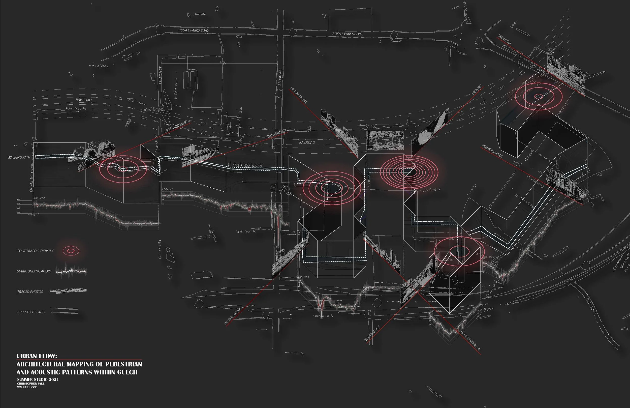
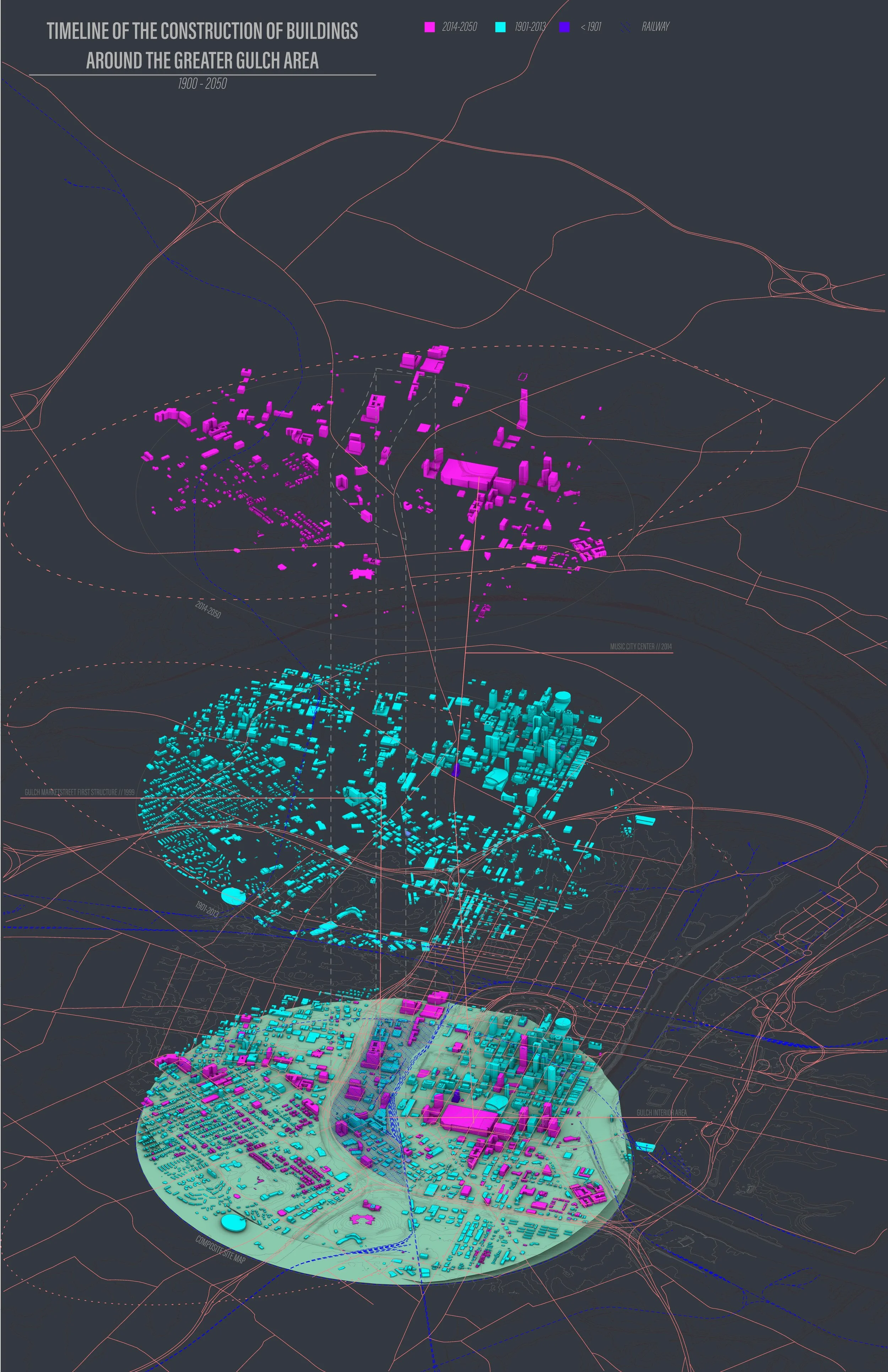
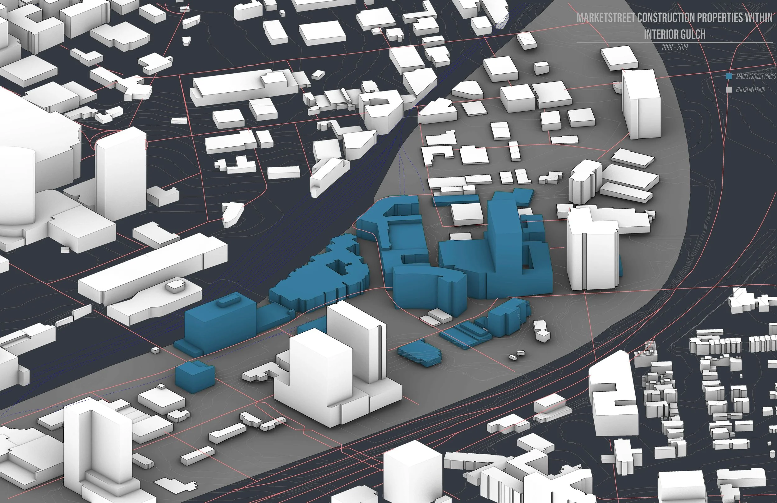
This project examines Nashville’s Gulch district—a high-end neighborhood between Music Row and downtown—through a series of urban mappings that combine ArcGIS datasets with field research to analyze noise, foot traffic, property development, and ownership patterns. Once a dilapidated rail yard, the Gulch was transformed beginning in the early 2000s by MarketStreet, whose large-scale investments now dominate its construction and infrastructure. Field studies included tracking foot traffic, mapping noise levels, and recording decibel readings to better understand the constant disruption caused by construction and heavy use. Layered with historical and property ownership data, these mappings reveal the Gulch as both a product of private development and a site of ongoing tension between high-density growth, urban experience, and questions of what the neighborhood might become.