CONNECTING WEHO
Proposal for a Transit area in the Wedgewood-Houston area of Nasvhille, Tennessee
Nashville, TN
Urban Planning
2024
Partners: Emma Kirby (ekirby9@vols.utk.edu)
Hannah Kirby (glg172@vols.utk.edu)
Audrey Reddick (areddic1@vols.utk.edu)
Software Used: Rhino 7, Adobe Creative Cloud, V-Ray, Blender, Unreal Engine 5, Maya
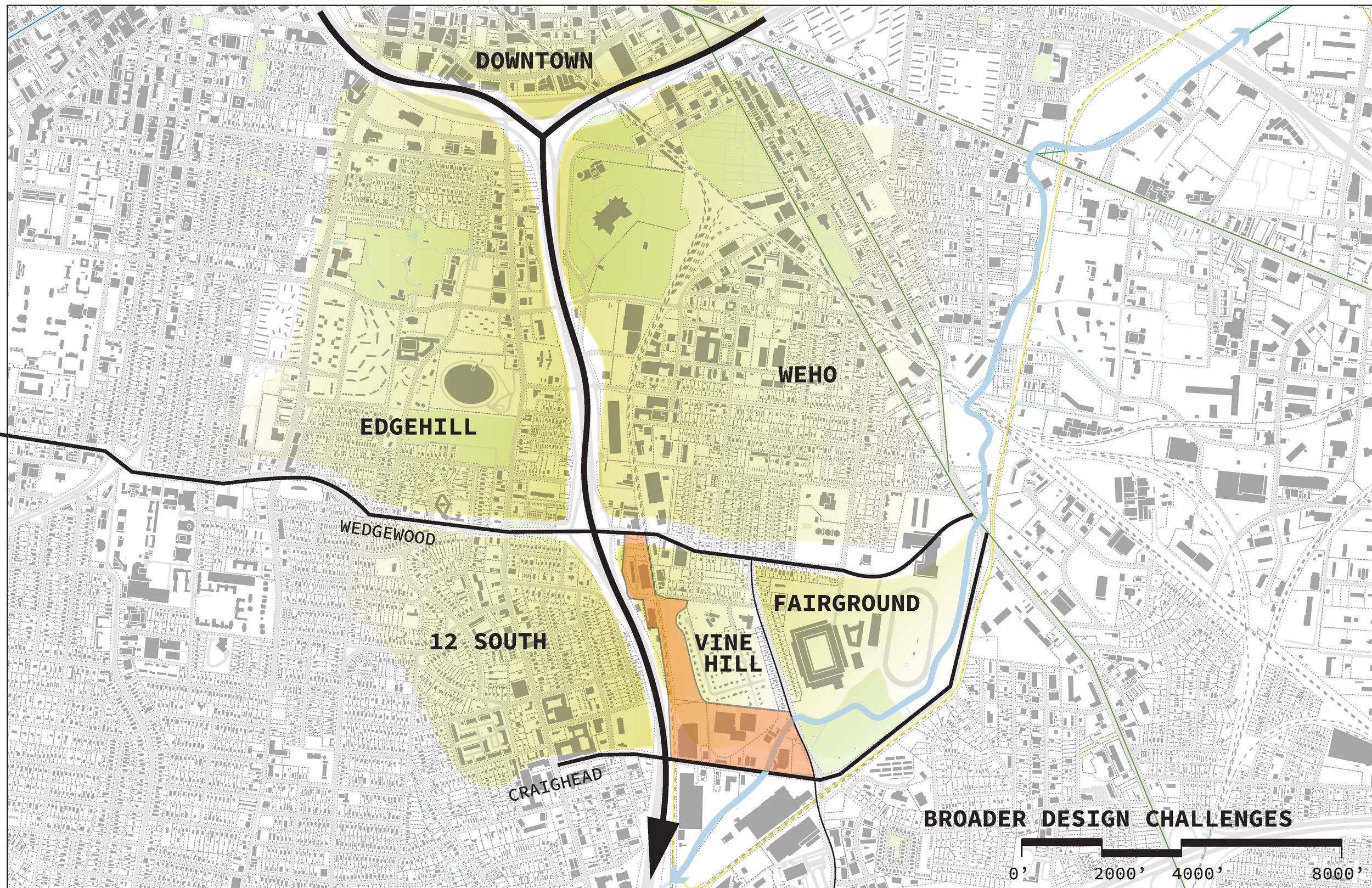
Located in Nashville’s Wedgewood-Houston neighborhood, this project responds to proposed light rail and BRT systems by transforming the fractured Vine Hill area into a dynamic, connected, and livable community. The 40-acre site, currently divided by interstate infrastructure and hard street edges, is reimagined as a transit-oriented hub where Browns Creek and a central greenway anchor circulation and public space. At its southeastern “knuckle,” a transit hub links Wedgewood Avenue to Craighead Street, balancing accessibility with green space and mixed-use housing to buffer adjacent neighborhoods. The design integrates retail-lined housing blocks, apartments connected by pedestrian bridges, and townhomes scaled to the existing community, with density tapering northward toward quieter residential zones. A central parking garage and transit platform support regional connections, while greenways, walkways, and bike paths prioritize safety and pedestrian experience. Oriented vistas tie the site to downtown, the entertainment district, and the soccer stadium, reinforcing its role as both neighborhood connector and regional gateway.
The development of the final design involved extensive hand-drawn tracings and iterative studies before transitioning into digital modeling in Rhino and other software. Initial tracings prioritized establishing a natural street grid that referenced the existing Vine Hill neighborhood while introducing new pathways to enhance connectivity to the central greenway. As illustrated in the provided tracings, early concepts emphasized maintaining a prominent greenway at the core and positioning the transit hub at the edge of the knuckle. Additionally, a residential district was strategically placed adjacent to the transit hub, creating an opportunity for long-term residents and visitors to engage with the evolving urban fabric.

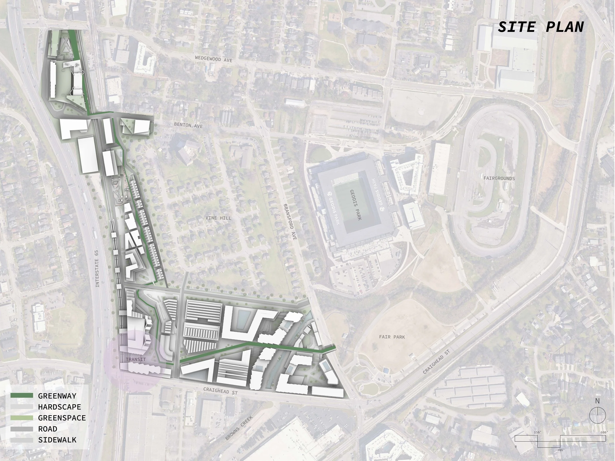
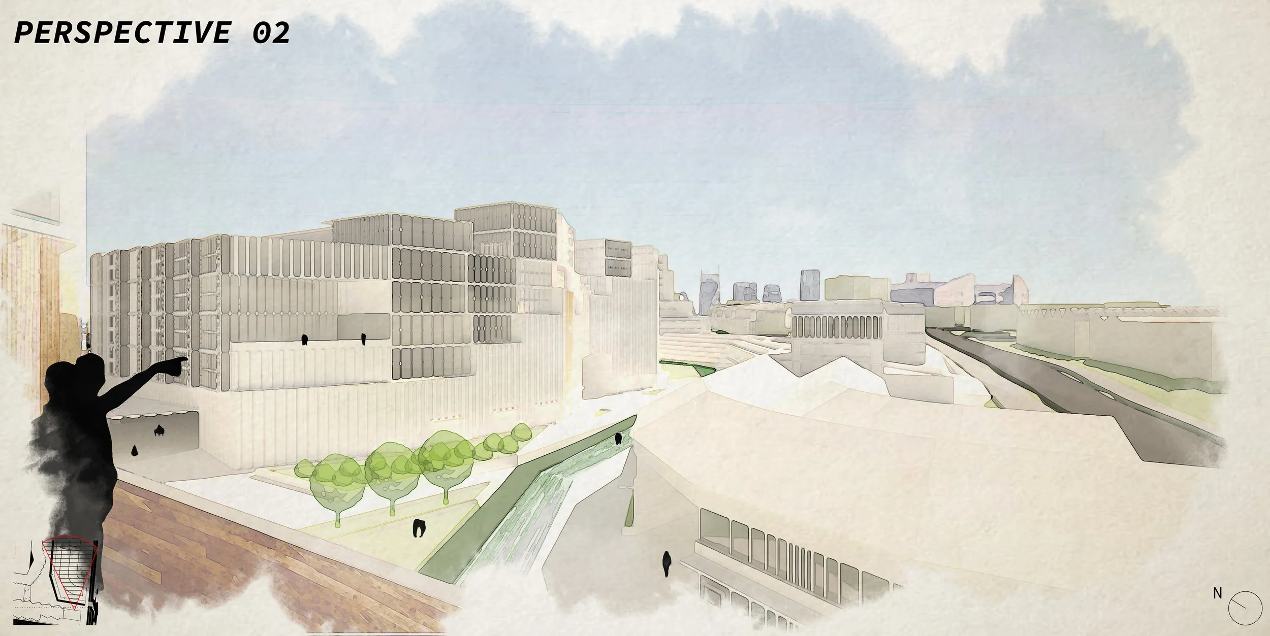
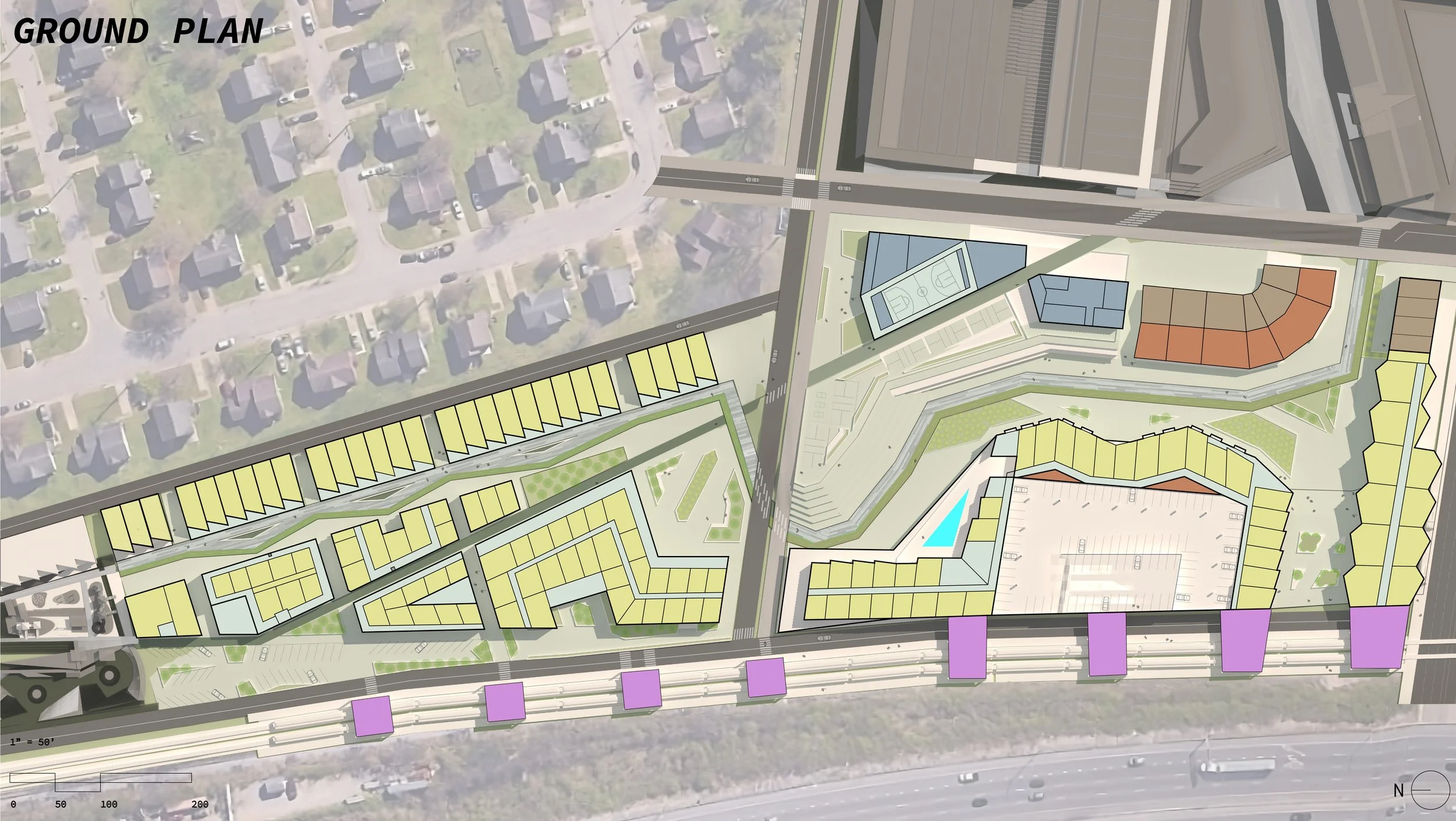
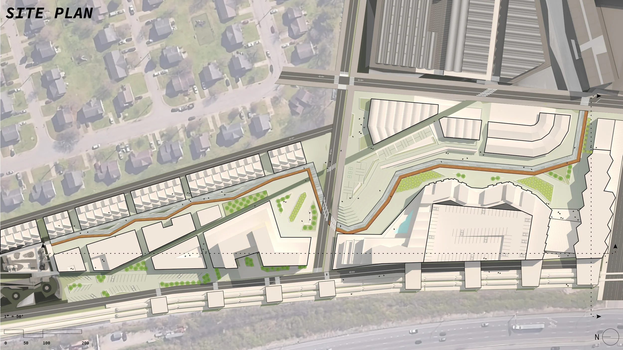
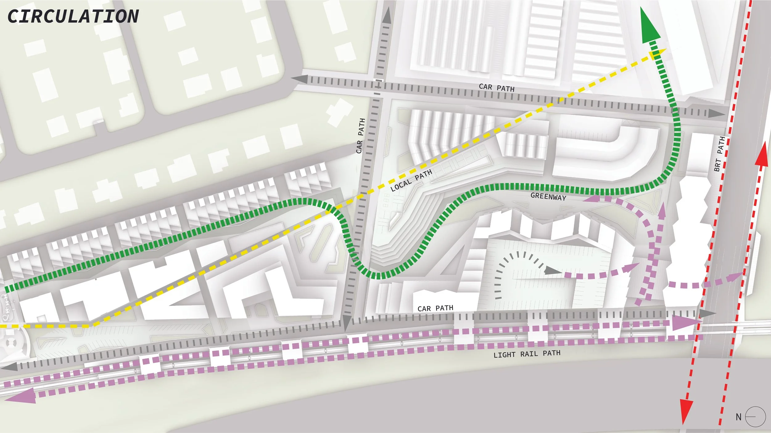


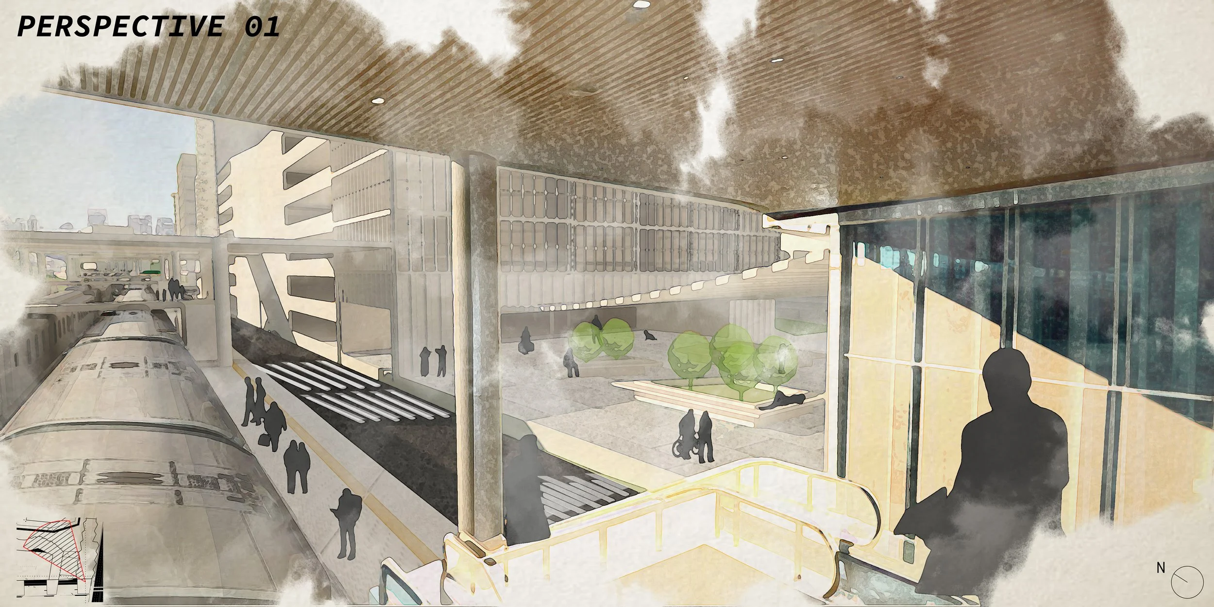
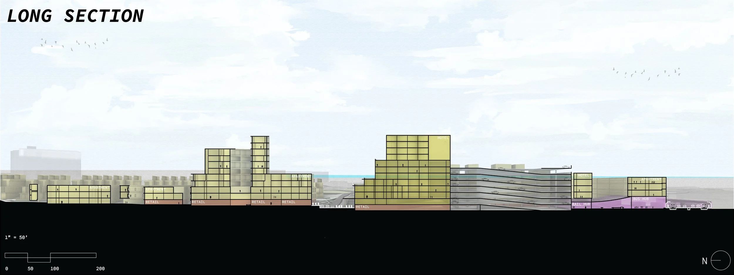
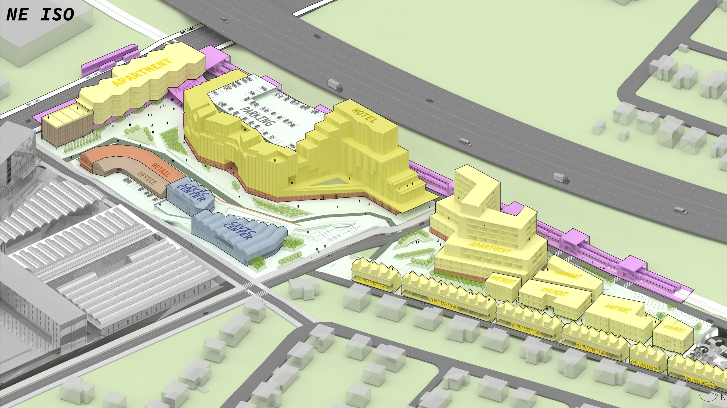
The final design establishes a 12-acre transit-oriented residential district at the knuckle of the site, integrating a diverse mix of programs to foster a dynamic urban environment. Townhomes, apartments, hotels, retail spaces, transit facilities, civic centers, parking structures, and office spaces create an accessible district. As depicted in the Iso above, the Light Rail hub extends throughout the site, featuring a 1,000-foot platform that allows pedestrians to disembark at multiple points. This integration seamlessly connects the transit corridor to the lower half of the housing district, facilitating direct access to retail, residential units, and public amenities while enhancing walkability and connectivity across the development